Friday, January 21, 2011

A Trip to Davao's Oriental Side

On March 12, 2010 I was informed by my Operations Chief ( Engr. Leo Ugto) that he would tag me along together with Maam Julie (our Admin Division Head) and Engr Tuquib ( PCO Coordinator) and of course my Kompare Allan on their travel Bagangga, Davao Oriental. Due to my eagerness to capture photos on my ancestral province I did not hesitate to join the group even without compensation as long as theres free food and accommodation.

We departed from Davao city around half past one which was originally 1:00 PM , thanks to Paquiao for he made the delayed arrival for some of our team.

Along the way to Mati, Davao Oriental( the Province Capital Town) we couldn’t help to stop for the scenic spots which the coastal road could offer,,, take some photos,,,, for some displays like the Canadian Rokies as they say and also another one forms like a sleeping dinosaur as you see a mountain range in the Pujada Bay area.

We arrived in Mati by 5:00 PM and we were joined with our office mates with another vehicle before proceeding to the Municipality of Bagangga which is our final destination but before we can leave , we have to wait for a few minutes for our pick-up truck got a problem with its starter but Allan managed the situation.

During our travel to Bagangaga from Mati, I transferred to sit at the back of the vehicle to capture scenic views , specially sunset of the area. On that ,we passed by the Municipality of Taragona which a beautiful scenic view on its mountain and coastal road that displays mountain ranges that could hypnotize any mountaineer by heart with the back draft of white beach with big waves at the bottom. I also got some beautiful cloud formations combined with mountain view in this town.

After Taragona, we passed Manay and had a couple of sunset shots then Caraga and by 8:30PM we arrived in Bagangga and we head directly to the house of our officemate who just passed away recently to pay tribute ..........

After having dinner ,, we were directed to proceed to a local Lodging house where we are goin to spend the rest of the night and wake up the next morning for the burial ceremony and then had an office related meeting afterwards.

In the place where we stay for the night , we the boys ( we are separated with our female companions) manage to have a social drink of Gilbeys which was offered by our companions from Manay and Caraga area and that social drink turned out to be long discussion of jokes and personal experiences and we went to bed very early for tomorrow.

Early in the morning I guess I haven’t sleep that night , he he he ,, we were waked –up by our chief by adjusting the air condition to coldest range,,,,,and we were forced to woke –up.....


After few minutes we got down and proceed to our companions house (Rene Baga, different from last night) for he offered that we would have breakfast there. While waitin for breakfast,,Allan and I manage to take a look at their beach front to capture sunrise photos for I was anticipating that Bagangga is facing the Pacific so the sun would rise from the sea.

On the beach front my eyes was stunned by what I saw,, I saw a huge set of waves which reminds me of my surfboards . I mean the waves are awesome big around 6-7 feet and favourable to a goofy like me,,,,,and promised myself to bring my surfboards when I get back on this area. In short I took some beach photos and sunrise photos then head back to our breakfast area.

After breakfast , we go back to our hotel then prepared ourselves to the burial ceremony of Rolando “Boloy” Baluyot our office’s In-Charge on that Municipality.

After the burial , we had lunch at Baluyot Family residence and had our management meeting there then head back to Davao city on that same Day.

Our trip to Bagangga is a beautiful experience for me for it allows us to bond as office mates in that short time and had better understanding to our individuality, and on the other side it exposes me and photographed to the scenic views that Davao Oriental could offer where you don’t need to spend huge amount just to experience this beautiful creations and all you need is travel time and proper timing......

Tuesday, March 23, 2010

Mt. Tampurong (An Un-spoiled Mountain on Mt. Apo's Foot)


Last February 27, 2010 I was invited by a mountaineering group named HADAMS ( Habagatang Davao Mountaineering Society) to join their training climb in Mt. Tampurong , Matti , Davao del Sur and due to my eagerness to climb the area and conduct a mapping ,, I joined without any doubt of what lies ahead of this adventure.


Tampurong as they call is one of the neighboring mountains of Mt. Apo with an elevation of 1,694 masl based on my Etrex Legend GPS by Garmin. Even with the low elevation compared to Apo, it still features several wild orchids and moss carpeting along the trail as proof of the area’s flora diversity. Also wild boars presence can be seen along the trail and also serpent eagle hawks and birds soaring in the area .


Our trek started in Brgy. Matti following a horse trail for about two hours goin to the base of Mt. Tampurong where we had our lunch and load water which would last until tomorrow for there is no water source at the campsite. Also we cooked our food for dinner so we would not require to bring more water for cooking.

On our way up , I consider it as a very technical one for there is no established trail and we just followed a hunters trail which was not used for a long period and according to Jun Aligway ( Hadams VP and Head of Operations) they climb Tampurong only once a year with not more than 30 participants that’s why it stays untouched that way plus considering the many Romblon leaves and other plants with thorns that could give you scratches .


The campsite situated in the summit is covered with ferns and moss under forest trees which could accommodate around 50 climbers or around 20 tents.


On the second day, we took the route on the left side of the mountain facing Brgy, Balutakay which brought us to Tampurong River that lead to what they Virgin falls where we refill water ,take lunch and had a splash on the clear water to refresh our warm bodies . After a while we continue the trek for around thirty minutes where we arrive at Campo 1 where our vehicle bound for Digos City awaits.


My experience to Mt. Tampurong gives me a different experience in mountain climbing and brought me to the most untouched place in my mountaineering carrier,,,,with a consolation of knowing new friends and gorgeous models for my blog,,,,,,Alright..

Wednesday, February 24, 2010

Samal’s Island Traverse Trekking to offer Extraordinary Adventure Experience

Written and based on actual experience by Julius R. Paner, MFSM External Vice President

When the Tourism Office of Island Garden City of Samal convinced the Mountaineering Federation of Southern Mindanao (MFSM) to facilitate a Traverse Trekking from Barangay San Antonio of Babak down to Barangay Aundanao, every mountaineer thought it would just be an effortless climb. Others considered a Putting-Bato experience as a basis for such an easy voyage and it could even offer just a common mountaineering activity. Well, it would be easier said than done. The real test will come March 3-4, 2010.


When I joined the reconnaissance survey last February 21-22, 2010 along with Gabo and Bryan, we discovered something unique about the trail. The ocular inspection turned out to be a trailblazing activity. We got lost twice, had to maintain a very efficient water management and had to go through several subsistence before we considered the trekking over.


Our first stop was at the house of a mountain guide in San Antonio. From there it took us 3 and a half hours before reaching the campsite in a cultivated farm land saturated with agro-forestry crops. Although the water source from the campsite is very far (just to warn would-be participants that the last station to refill water is at the house of a mountain guide in San Antonio), what’s good about the campsite is that everything about Davao City is visible especially in the evening.


The next day, we thought once again that the trail going down would be just as simple as eating peanuts. Alas, it never looked that easy either. As Bryan would put it, it could be a “White Peak Material”. We had to pass through bushes of bamboo species with a trail that was as small as our slippers. So small that we must take extra care not to stumble or else we would be rescued down under as deep as the Pacific Ocean. We were walking on top of a ridge, all ridges…and when we thought we were on the right track going to Aundanao being the trail tail, we instead passed the other dead creek with destination unknown to all of us. Thinking that streams flow directly to the ocean, we followed its minute flow and eventually landed in a different destination. We landed instead to Sitio Kima.


Several mountain ranges can be viewed while we were traversing one ridge after the other. The highest point we recorded was at 500 masl and the rest offers medium-range mountain crests. There will be portions of the trail where a rope should be installed for easy climbing access. Once again, there is no water source in the area, that’s why I would like to mitigate everybody of efficient water management and to bring enough water for personal consumption (although we asked the village folks to bring potable water for sale during that date). The trail was previously elapsed by human beings (particularly by local folks) on August 2009. We were in fact the first mountaineers who stepped into that part of the world and it was the first ever in the history of Philippine Mountaineering (heheh). Along the way, we saw several wild orchids carpeting a huge part of the trail, proof only of the area’s flora diversity.

In a nutshell, this upcoming climb promises to be a mammoth experience for us. Another good point about the trekking is that it will be finished off in an incredible island of Canibad. It might just be a minor climb but the experience will somehow be “blue-chip”. #


Thursday, February 18, 2010

Samal Island Traverse Trekking

Note:
Registration for NonMFSM members is P 180.000
Register @ Mulllatto Outdoor Shop
CM Recto Street , Davao City
or Contact Engr. Albert C. Gabriel @ 09193142117
Julius Paner @ 09208567991
e-mail @ mfsmincorporated@gmail.com

Monday, February 15, 2010

The Oldest Foreigner Who Conquered Mt. Apo via Sibulan Sta. Cruz Trail


On February 13, 2010, I took the honour to guide David Walladge to conquer Mt.Apo ( Philippine’s highest mountain) with the help of Bryan GabaƱete (my sweeper and medic) and Anzel Camad ( a local porter).

David who looks like Sean Connery in the movie “ The Rock” (born and raised in Australia who mostly lived in the outback and work for about thirty years as a telephone repair guy) is already in the prime of his life at sixty years old when he did this climb and that makes him “ The Oldest Foreign Mountaineer “ who reach the top of Mt. Apo via Sibulan Sta. Cruz Trail which I consider the most technical trail of the mountain.

With his superb physical strength and determination considering that he has only one lung ( fifty percent of both lungs are working) , we reach the summit on the second day before noon and managed to get back on the third day as per itinerary which I designed for average hikers.

Congrats David ,,,,,,,,,,,,,,,

For more info about Mt. Apo and photos, kindly visit: http://mtapoadventure.wordpress.com/ or just click the link on the right with Mt. Apo Adventure on it.


Thursday, December 10, 2009

Mt. Apo's Best Photos in 2009

During the my few years climbing back and forth in Mt. Apo bringing guests, mountaineers and hobbyist, this year was awesome for I had experienced the best weather and took the best photos of its features, specially its sunsets and sunrises.Here are some of it,, enjoy.....


Try to visit this link for more info about Mt.Apo
http://mtapoadventure.wordpress.com/

For Inquiries and Bookings Please Contact:

Engr. ALBERT C. GABRIEL
MCTCA Eco-Tourism Vice- Chairman
Mobile # 0919-3142117
E-mail Add : adventuregabo@yahoo.com.ph

Monday, July 27, 2009

Trekking to Bani Water Falls ( Day 2)

I woke up around 5 Am in the morning the next day. The skies are blue and clouds turned into orange colored cottons on some of its parts . The morning mist cools my nose so I have to put a bonnet on my head. The lowest temperature that experienced since last night was only 18 degrees Celsius which is much hotter compared to MT. Apo’s base camp in Tumpis.

After our early breakfast ( corned beef and vegetable on tomato sauce with rice), we prepared our things for the days trek and break our camp. We leave some of our things to one of the locals house and pick them up upon our way going home in the afternoon.


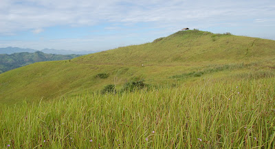
Half of the total trail going to the water falls is a bushtrail up to your waist which reminds of a picture in Mt. Pulag in Luzon which resembles it and I said to myself , this place could be Davao’s version of Mt. Pulag but of course its trail will lead to a waterfalls .


An hour of walking we reach a small hat on top of a hill where you could just sit there and satisfy your eyes with beautiful landscape and the most exciting part is Bani Waterfalls is part of the scenery , I mean the whole waterfalls is visible to your naked eyes while staying there.

After a couple of minutes of relaxing we start descending to the foot of the water falls following the same bush trail but about few minutes walk the trail shifted to a step trail with trees and small plants on the side which we hold on for we would surely go down directly because its slippery.

All those things that we endure seem to vanish when we reach the foot of the water fall . The river that runs from the water falls shallow and you could go swimming on it. Some of my companions went to the drops for a water massage. In that place we ate our packed lunch and stayed there for almost 30 minutes.

When we go up, we used the trail on the right side of the waterfalls, its sounds cool but the level of difficulty is way much higher compared to the trail going there. It is also as steep as we go down but imagine going up on a slippery trail with a cliff on your right side and you rely only to the small roots to hold on.

In the middle of the trail going up you will reach the waterfalls natural pool and follow the cascading water trail to reach the top.

At last after two hours of hard labor on the treacherous trail we reach the top of the waterfalls . At that moment I was relieved for I know that the next trail would be easier. In that place I realized that we just climbed the whole water falls from bottom to top , whew and from where I sit I could see in front the mountain where I took the first shot of the whole waterfalls .

Our adventure to Bani Waterfalls is gives different experience to me and my companions , it shows me a different type of waterfalls , trail that resembles the view on top of Mt. Pulag and specially climbing on the top of the water falls in which I never realized before that we are goin to that at a first glance . Yet ,this whole trip marked happiness and enjoyment for all of us and saying to myself “ I’ll be coming back”.